Search by voice
Windows
Mac
Windows
Log in / Sign up
Windows
›
Tags › gis mapping
Featured
GIS Mapping
Software
Relevance
Popularity
Rating
Gix Export Tool
free
23
by yecarrillo
This extension helps GIS developers to migrate ESRI ArcView projects to the most popular Free and Open...
Systems (
GIS
). Features: - Auto-creation of .
map
, .fnt...file for reference
map
of MapServer
Hazus-MH
free
22
The Federal Emergency Management Agency (FEMA)
Hazus is a nationally applicable standardized methodology that estimates potential...
Geographic Information Systems (
GIS
) software to
map
and display hazard
ArcGIS SP1 for Desktop Set Bing Key Patch
22
Environmental Systems Research Institute, Inc.
ArcGIS SP1 for Desktop Set Bing Key Patch is a program that addresses changes to Bing licensing by allowing...
continue to use Bing
map
services. The patch
SHPTRANS
free
15
Bruce Dodson
The input and output coordinate system can be any of these projections, or lat/long...
as those within ArcView
GIS
3.x and ArcGIS 8.x...projection is specified, the
map
units are taken
Aexio Xeus
free
15
Aexio Software
Xeus is a comprehensive solution designed for RF Engineers by RF Engineers. Xeus heightens engineering productivity by providing...
daily optimization support
GIS
software, Xeus integrates...Supports Bing™
Map
feature from MapInfo™
ATDI Global Mapper Plug-in
7
ATDI Limited
Global Mapper is a GIS tool for map data format conversion. ATDI have developed the Global...
Global Mapper is a
GIS
tool for
map
data format conversion...of most custom
map
Point Analyst
6
Dr. Rob Rempel
Analysis of map similarity: Linear regression analysis of two maps...
to the ArcView®
GIS
designed...) interpolation. -Generate reference
map
: Ability to generate
ERDAS IMAGINE Example Data 2011
free
5
ERDAS Inc.
ERDAS IMAGINE Example Data 2011 is a program that offers some data samples for ERDAS IMAGINE 2011...
digital images for
mapping
use in
GIS
or in CADD
GeoSync XG Manager
1
MapSync
Utilize GeoSync® XG to author and distribute powerful, cost effective, and easy to use GIS desktop viewing applications...
and easy to use
GIS
desktop viewing applications...harnessing ArcPublisher to create
map
files (.pmf)
PixPoint for ArcGIS
ESRI
PixPoint can also be used with ArcPad, providing more options...
and ArcGIS to make
maps
better with PixPoint
MapAscend Productivity Enhancements for ArcGIS
MapAscend
The Attribution Enhancements Extension streamlines various data entry tasks...
The Attribution Enhancements Extension streamlines various data entry tasks
1
…
3
4
5
6
7
8
9
Tags
Software
Data
Internet
Online
Bing layer
Set Bing key
Bing key
ArcGIS patch
Bing licensing
Fix issues
Featured stories
See all
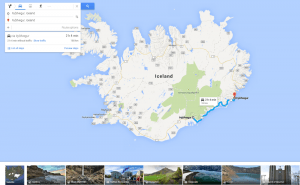
More Opportunities For Trips With Google Maps
Google Maps has recently released a new set of features that will definitely improve user traveling experience.
Mind Mapping Tools: Not To Lose Bright Ideas
Here goes a list of mind mapping tools that will surely help visual thinkers avoid half-concepts and patchy schemes while brainstorming.
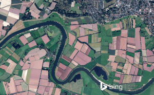
New Bing Maps Preview Focuses On Travelling Plans
Bing Maps Preview has just been updated with a few features that make planning your trips much more convenient.
Halo 5's map editor is now available for free in Windows 10
Unfortunately, Microsoft didn't give us any official information about when or if the game itself will be coming to Windows 10.
Draw on Windows Maps
The default Maps app that Windows offers gives you some very handy drawing options. Here's everything that you need to know about it.